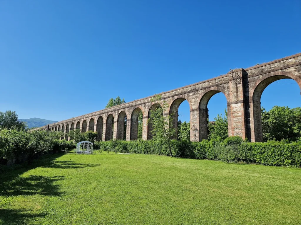
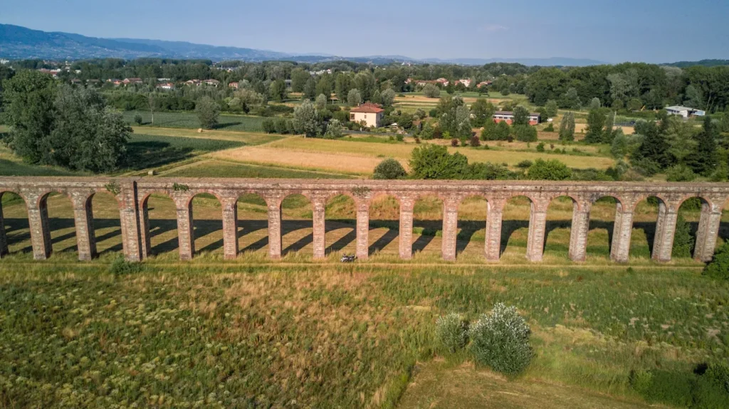
The Acquedotto del Nottolini is a long run of brick arches that runs across the countryside for more than three kilometres. It’s a 19th-century piece of engineering, and once you know the story, walking it becomes a much richer experience.
This guide covers what makes the aqueduct special, how to walk the route from Lucca to Guamo, what to look out for along the way, and some tips for planning your holiday.
What is the Nottolini Aqueduct?
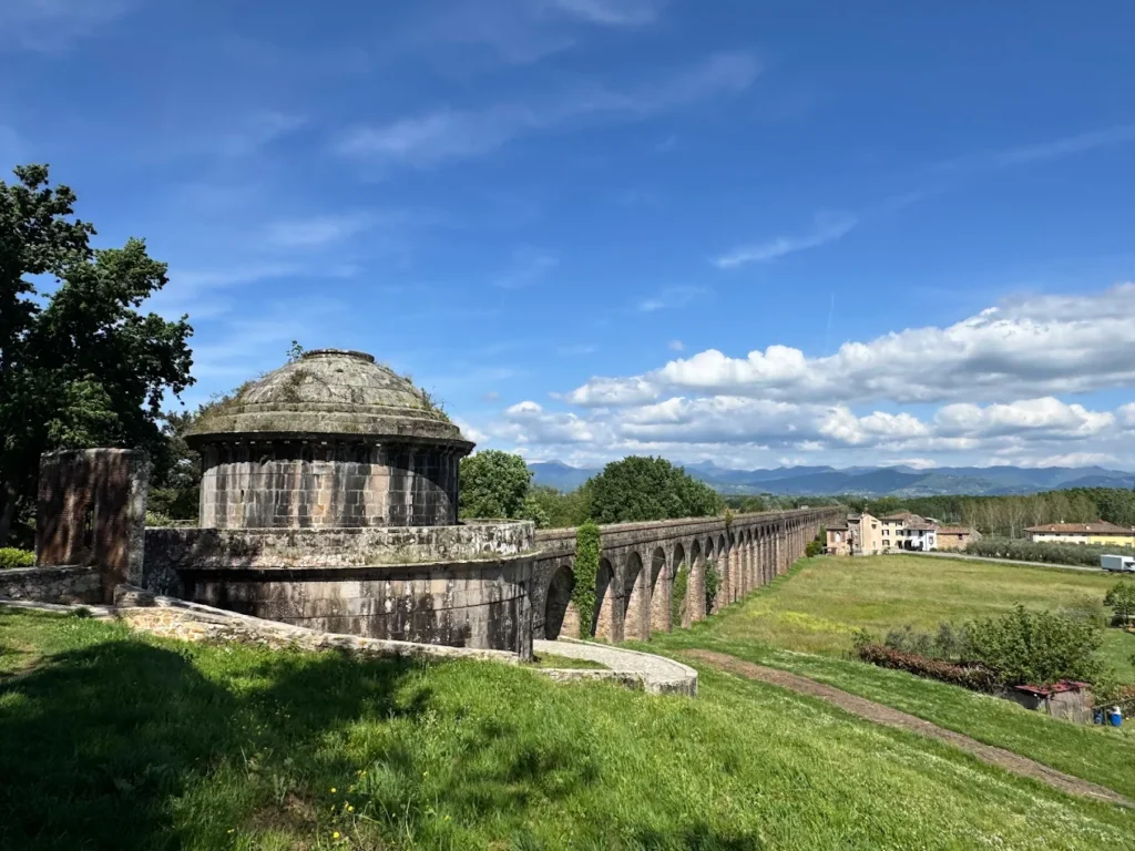
The Nottolini Aqueduct is located just south of Lucca’s railway station, and yet plenty of people stay inside the walls and never see it. It has more than 400 arches, stretching across roughly 3.2 km of flat Tuscan farmland, with a small Doric temple at each end.
Today, it no longer supplies water to the city, but the brickwork is largely intact, and the path that follows the arches is open and free to use.
Interesting facts
- Length: around 3.2 km of visible arches
- Number of arches: more than 400 (often cited as 459)
- Built: 1823 to 1851 by Lorenzo Nottolini
- Commissioned by: Maria Luisa of Bourbon, Duchess of Lucca
- Water source: springs on Monte di Vorno and Monte Pisano
- Endpoints: Tempietto di San Concordio and Tempietto di Guamo
- Access: free, open 24 hours, no ticket required
History and architecture of the Aqueduct Nottolini Lucca
For many years, Lucca received water through its wells. However, by the 18th century, that wasn’t really working as hygiene was a growing concern, and the city kept commissioning studies on how to bring spring water in from the hills.
That’s when water was gathered from around 18 mountain springs in the Serra Vespaiata, Rio San Quirico, and Rio della Valle areas, then sent north along the arches to a second temple-cistern at San Concordio just outside Lucca’s walls. From there, iron pipes carried it under the Baluardo San Colombano into the city’s fountains.
The route of the Acquedotto del Nottolini from Lucca to Guamo
The walk from one tempietto to the other is the classic route for the Acquedotto del Nottolini. It runs from the south edge of Lucca, across open farmland, towards the foothills of the Monte Pisano.
How to reach the starting point
- On foot from Lucca train station: 10–15 minutes south to the Tempietto di San Concordio
- By bike: easiest for the whole route; rentals in the centre cost roughly €5–€10 per hour
- By bus: VaiBus lines from central Lucca stop near San Concordio (tickets around €1.50)
- By car: head to Via del Tempietto in San Concordio; street parking is available but limited at weekends
- By taxi: a short ride from central Lucca, usually €11–€14
What the route is like
The path is flat for the whole 3.2 km, with a surface of compacted earth and grass, ideal for families. The only slightly awkward bit is the metal footbridge over the A11 motorway, with a few steps where bikes need to be lifted.
What to see along the route
The arches themselves are the obvious must-see, but the two cisterns at either end are where the architecture really shows off. Both are small circular Doric temples in unmistakably neoclassical style.
Tempietto di San Concordio:
Built between 1823 and 1825, it sits just behind the railway station on Via del Tempietto. Inside, a large marble basin once divided the water into two channels feeding the iron pipes that ran into the city.
Tempietto di Guamo:
The southern end, where spring water first arrived after being channelled down from the mountains. It sits in a rural spot near San Quirico, surrounded by olive groves, and tends to be quieter than San Concordio. Many locals consider it the prettier of the two.
Practical tips for the walk and visiting hours
Because the path is an open monument, there are no opening hours and no entry fee.
Must-do checklist before you set off
- Bring water, as there’s nowhere to buy any along the route
- Wear proper walking shoes; the path is uneven in places
- Take a snack if you fancy a picnic near the arches
- Check the weather forecast; rain turns parts of the path to mud
- Allow 2–3 hours for the full out-and-back walk
- Pack sunscreen and a hat in July or August
Best time of year to visit
- Spring (April–June): wildflowers, mild temperatures and clear views, probably the best window
- Autumn (September–October): grape harvest in nearby vineyards, warm light, fewer walkers
- Summer: doable but hot at midday; aim for early morning or after 5 pm
- Winter: atmospheric, but expect mud and short days
Making it part of a wider Lucca itinerary
The Nottolini Aqueduct works well as a morning or late-afternoon outing, which leaves plenty of time for the rest of Lucca around it. Most people walk the full route in about two hours, so it pairs neatly with a half-day inside the city walls or a longer day out into the countryside.
If you’re staying in town, the easiest plan is to do the aqueduct first thing, head back into the centre for lunch, and then spend the afternoon on the Renaissance walls.
From there, the cathedral of San Martino, the elliptical Piazza dell’Anfiteatro, and Via Fillungo for shopping are all within easy reach.
Climbing the Torre Guinigi for its rooftop oak trees is worth the 230 steps if your legs aren’t too tired for the trek up.
Come and explore the Nottolini Aqueduct
The Nottolini Aqueduct is unfortunately not so well known, but it is a great cultural and architectural find in Lucca.
It’s free, it’s quiet, and it gives you a real sense of how the city functioned in the 19th century.
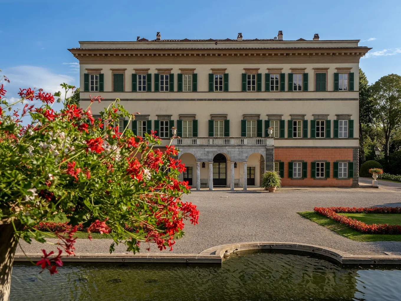
If you’re still thinking about where to stay, Lucca Apartments and Villas can help. We look after a carefully chosen collection of villas in Lucca and apartments in the city centre, from historic palazzo flats to countryside villas with pools.
For something more exclusive, take a look at our luxury villas, for places closer to Guamo and Vorno. Book your stay and enjoy Lucca and its surroundings.